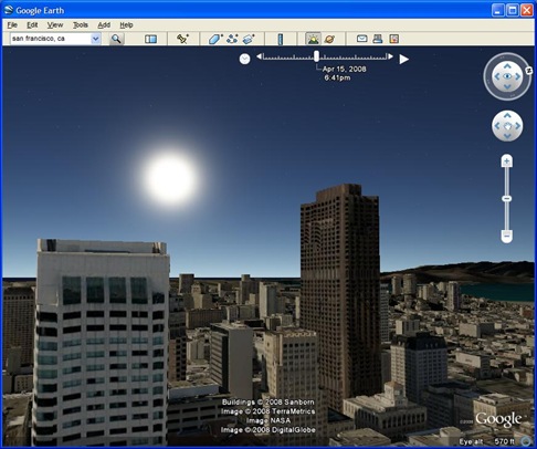
Today Google released the latest version 4.3 of Google Earth. Google added lot more feature in this latest version and with all of the great user-created buildings in the 3D Warehouse. With the Redesigned Navigation system you can fly very smoothly from the heavens down to the streets of your town. The most important feature I like is, you can view the exact date of a particular satellite image.

Here are some of the Feature available in Google Earth 4.3
- New navigation - We've improved the zoom control so you can swoop down from outer space to street level in a single seamless motion. And with the addition of the "look" joystick, you can look up at buildings or across a mountain range.
- More, faster 3D buildings - It's more fun to navigate through a lot of new 3D content. Besides adding thousands of buildings contributed by people around the world, we've added dozens of photo-textured cities and towns in the U.S. and elsewhere.
- Street View - The popular Google Maps feature makes its Google Earth debut.
- Sunlight feature - Never seen the sunrise over the Alps? Now you can.
- New languages - There are 12 new languages, including Danish, English (UK), Spanish (Latin American), Finnish, Hebrew, Indonesian, Norwegian, Portuguese (PT), Romanian, Swedish, Thai, and Turkish.
- Imagery Dates - As I said above, You will be able to see the dates of a particular satellite image.
Here is a Video Tour of Google Earth 4.3 from gearthblog.com.
Download - Google Earth 4.3


The possibility of seeing the date of the satellite photo is available for a long time, for so many versions, but it's only now that it's been brought forward.
I like the 3D thing, but since my video card is a bit old, I have to turn it off most of the time.
:)
Are you sure that this imagery dates feature was available before? I don't think so.
Can you tell me, how to see imagery dates in older version. Will be thankful.
Thanks